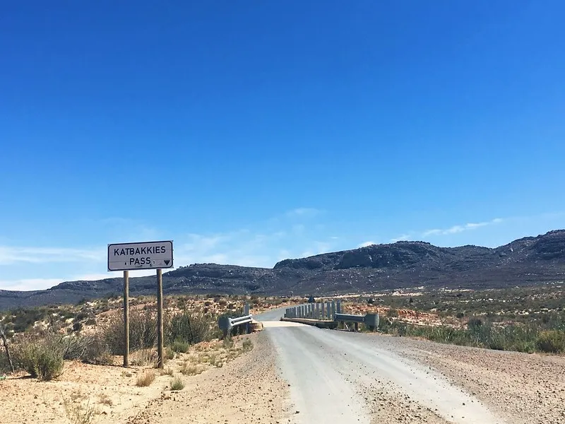
Gear down and prepare to conquer the challenging ascent of the Katbakkies Pass in the Cederberg, a thrilling drive through the rugged mountains of the Western Cape with breathtaking views of the Koue Bokkeveld.
The Katbakkies Pass attracts brave drivers and cyclists seeking punishment amid stunning natural beauty. Luckily the very steep section of the pass is tarred, but the rest remains gravel. As you ascend, you’ll be rewarded with panoramic vistas of the surrounding Cederberg landscape, making it a memorable journey for outdoor enthusiasts and nature lovers alike.
Origin of the name “Katbakkies”
Katbakkies Pass, with its evocative name, is thought to derive from the mountain that resembles a cat’s face, though some suggest it may stem from the steepness of the ascent, reminiscent of reversing into a boot (kattebak). Apparently due to the pass being so steep, pre-war vehicles had to reverse up the mountain, which would mean boot( kattebak in Afrikaans) first. This ambiguity is compounded by historical confusion, as Skitterykloof (also known as Peerboomskloof) was once mistakenly called Katbakkies until the true Katbakkies Pass, located 15 to 20 kilometers west, was correctly identified. Despite these theories, the true origin of the name remains uncertain, adding to the area’s intriguing local lore.
Katbakkies Pass Route
The scenic route connecting the Koue Bokkeveld with the Ceres Karoo via Katbakkies Pass and Skitterykloof (Peerboomskloof) offers breathtaking vistas that captivate photographers and nature lovers alike, especially from the first lookout point. Summers here are really hot but short whilst winters usually include snow.
Renowned as the southernmost part of the Tanqua Karoo, this area boasts abundant birdlife that enriches the landscape and provides a compelling reason to explore further. The journey promises memorable panoramic views and fascinating wildlife, making it a must-visit for feline fanatics and adventurers visiting South Africa.
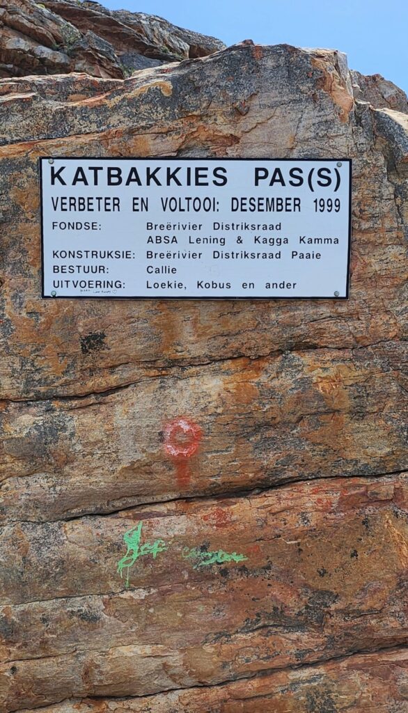
Katbakkies Pass, once an old sheep-trekking route over the Skurweberge mountains, now connects the Koue Bokkeveld with the Ceres and Tankwa Karoo regions and was tarred in 1999. Despite its short length, the pass features a steep average gradient of 1/13, challenging underpowered vehicles, especially on the two sections about a quarter of the way up the western ascent where the gradient exceeds 1/4. Occasionally snow blankets the pass during winter, as its maximum altitude of 1200m is above the snow line at 1000m ASL.
The narrow, unmarked road offers a breathtaking, barren landscape, so proceed with caution and take your time to enjoy the scenery.